Thursday, October 28, 2010

Hoheward (experimenting with video on a coal dump in Ruhrgebiet)

So a friend from home tells me about this contest where you can win a job as a professional vacationer. A professional vacationer visits the most wonderful spots on Earth and posts video blog from and about his adventures.

To win the job, you have to send in a video - something Ive never really tried before - so we took a trip Sunday, my one day off, to a new halde, that is to a coal dump, we've never visited before. Coming straight out of work as I did, I cant say I was super prepared... for example I forgot to charge all the batteries, and I hadnt researched enough or thought enough about what I wanted to shoot.

The halde itself is amazing - the mining companies have been dumping tailings there since the late 1800s and theyve built up a hill 100m high - from the top you can see all the way to Düsseldorf, 50km away. And on top theyve built an astronomical measuring device - a sort of modern day steel stonehenge - two great round arches each 45m in diameter - you can see them clear as a bell from the A2 - you can see them on the horizon from downtown essen if you know where to look

ive know, and ive been looking and wanting to get to this halde for a while - there is something magical about these big piles of dirt. theres 30 of them in the ruhr area, 8 of them over 100m - all wrapped with trails winding round and round, green forests slowly marching up the slopes, great views, the wind, the open horizon

i love standing up there and looking out over the countryside - in some ways its the closest thing to the sea theyve got here in the ruhr area - i can breathe up there - i can relax

that feeling though is exactly what i failed to capture in my video - why are the halde so attractive to me? - however for my first attempt at making a video, i am satisfied - before i began the project i wasnt even sure i had the software, let alone the know-how, to stitch the clips together or edit them - now i know i can - i managed to create a bit of a story but most importantly i learned a lot:


- 1 - plan plan plan - think about things like: why would people want to come here? what info is necessary to sell them on the idea of going, and what info can they discover for themselves? what shots do i need to sell the location - what pictures, what feelings, whats the story?

- 2 - charge all batteries - duh!

- 3 - show dont tell - action is more exciting than some dumb talking head - what do people do at this location? how do the move through or interact with the geography? is there a story that can be told or a feeling that can be conveyed with moving images rather than words or still shots? if there is talking, why not some colourful LOCAL character instead of boring old me?

- 4 - wind sucks

- 5 - check the spelling of the one word in the title - duh!

- 6 - have fun!! life is too short for anything else

now that im more familiar with the process, i have to spend a bit of time (but i dont that much time) thinking about what "attraction" id like to feature here in essen and what i want to show to say why im the right guy for the job...

anyway, heres the video - the best thing about is the ending for sure...

and here are my fotos from the hike (with batteries running low i didnt take anywhere near the number i would have normally taken but then im pretty sure ill be back)

Wednesday, October 20, 2010

Power caching on the Dobson Trail ( 71 caches while walking through a swamp)

71 caches while walking through a swamp

P9010057

Starting in the dark at the northern border of Fundy National Park

My biggest day weekend of geocaching was a huge drag – by the middle of the second day I was tried, wet, hungry, bored, lonely as hell and not really sure why I had done it to myself.

I was hiking alone along the Dawson Trail – 58km of swamp and marsh between Fundy National Park and Riverview New Brunswick. Along the way I picked up 120 caches, 71 of them in one day. It was pure hell.

In retrospect, I should have talked some sucker into coming along – they would have hated me for the rest of their life, but at least I would have had some company for the weekend.

It all started with statistics – instead of enjoying each cache, the search, the journey, the quest – I was focussed on numbers.

By the end of August 2010, I had 821 finds and I was really hungry to break the 1,000 mark. I had a couple of 40-cache days behind me – one with my son driving and me caching (after which i wrote these top ten tips for the power cacher); and another day alone and on foot on the trails around musquodoboit.

P9020126

The Dobson Swamp

But this trip to New Brunswick was different – these caches on the Dawson Trail had all been laid out in a straight-ish line – one after the other every 300m only a few steps off the trail – this boys and girls, we call a “power trail”.*

A cacher with the game name of Hillybilly Bob (he’s from Hillsborough NB) laid out and maintains these caches along a trail he obviously loves. For me the trail has its water in all the wrong places – Id prefer sweeping views of oceans or wild rapids – rather than wading in swamps and splashing through the rivers.

More fotos from the Dobson 120 on flickr

But i didnt come here for scenery. My goal was to not only break my previous one-day record of 48 caches, but also to beat the record of a friend of mine who had found 83 – working in a team of three and a driver.

my “team” consisted of a good friend who agreed to drop me off in the middle of nowhere – the dawson trail starts at approxiamately N45° 41.730 W65° 00.500 on an old backroad some call the Old Sheppody Road but the maps call the New Ireland Road – whatever its called, the dirt road runs along the northern border of the Fundy National Park and while most of it is smooth gravel, parts of it are rough – big puddles and wash outs galore.

P9010078

Meeting a fellow hiker on the Dobson Trail

my buddy dropped me off round 6.30 am, about 15 minutes before sunrise – i had my first cache at 6.40 and was underway – the weather turned warm and the trail for most of the first day was dry – strangely enough at one point walking down a stretch of road i ran into a beaver who was walking the other way down the road – he didnt seem the least bit bothered by me at all – he just kept on his way

i had my first real break – with water and sandwiches round 9.30 – 3 hours in, i had covered 6k of the trail and i had found 22 caches – a little better than 7 an hour – or a cache every 8 minutes – an exhilerating pace

it was a full day. a blur mostly.

the trail is not what you would call gorgeous when youre used to, as i am, to hiking along the shore – say around cape chignecto or in cape breton into pollets cove – this is a tromp through the woods – i saw a lot of trees – and yes, by times the woods are very beautiful and peaceful

P9010086

Blackwood Lake; the first and only vista of day one on the Dobson

later that day the trail got considerably wetter – downright swampy even – i tried to keep my feet dry – a critical thing when hiking long distances – in the morning there had been occassional big puddles a couple hundred metres long, requiring short detours

but eventually i came to stretches where the trail led right through swamps – the trail was a swamp, right and left was a swamp – everything was a swamp – there were other bits where streams and rivers were flowing the length of the trail and the woods to either side were thick impenetrable spruce stands

around 11 ‘oclock i came to blackwood lake – the first view of any kind i had had all morning – and really the only view id have until 6 when i climbed up the top of Hayward’s Pinnacle – a pointy little peak in the middle of the woods

the trail up was extremely steep and led to a rocky little summit with views north all the way to moncton

i was exhausted, naturally, and it was the first place that looked like a campsite – where i might feel safe sleeping

P9010099

The view from Hayward's Pinnacle. Camp on the first night.

i had another hour and a half of light but i didnt want to risk not finding another site so good for sleeping – i stuffed my face and wrote in my journal (which must be in canada because i cant find it here in germany)

my log account from that final cache of the day:

6.20 pm
exhausted. climbed up here to sleep. snoring by 7 pm.
great view of moncton. even greater when i woke at midnight – the long string of lights along the horizon.
first and only really good vista along the whole of the dobson

last of 71 on the first day of hiking the Dobson Swamp
parts of the trail are real nice and big parts of it are real swampy

T4TC

so early to bed meant of course i would wake early – i got up for a while at midnight – ate some more and watched the lights of moncton twinkling in the distance – my destination didnt seem that far away from way up here

P9020108

stumbling around follwing blue trail markers in the pre-dawn dark

i was wide awake by 4.00 that morning and anxious for the sunlight that would allow me to start – i stuffed myself with food and waited in my bag til i couldnt stand it anymore

by 5.00 i had descended from the pinnacle and had found my first cache – in pitch darkness – by the light of a headlamp – i got thumped by a lot of branches and discovered that it can be very tricky getting back onto the main trail in the dark

after one cache i walked over the main trail twice without even seeing it – in the end i had to use the “track” function on my gps to get back on the trail – i learned then the importance of noting extra carefully how to get back to the trail when bushwhacking in the dark

P9020106

Third cache of the morning (5:50am) looking in a stump with a headlamp

so everything was a bit slower in the dark naturally – i only found five caches before i put away my headlamp at 6.22am

at 7.30 that morning i found my 8th cache of the day, my 79th of the trip and therefore the magical 900th overall. only another 100 to break 1,000. at this point i was still believing it was possible to push hard and find more than a hundred that day

at 8.15 i passed by a great campsite – a cabin shelter where i could have slept safe and sound with a fire place and a bed platform – next time!

my hopes of breaking 100 on the day remained alive until a little after 10 when i started looking for the Prosser Brook Ridge Lookoff cache – i just couldnt find the silly thing – up to then i had found every cache – all 91, so i really wanted to keep my perfect streak alive – i looked way too long here – for an hour – and out of frustration i took a half-hour nap

P9020115

the sun coming up on day 2 on the dobson

in retrospect i should have stuck to a 15 minute rule – i could have found six caches in that hour instead of none

a lot of the second day’s hiking was easier though – a short stretch was actually along paved highway and a few hot dry kilometres were along a wide gravel road – at one point on the gravel road a mother bear and two cubs appeared about 50m in front of me but disappeared back into the woods just as quickly

as the day continued the total of DNFs (did not find) started piling up – in some of the hilly areas i had big time satellite reception problems. finally at 5pm, with only 48 finds, i gave up caching entirely and started walking for moncton in earnest

i had covered 37k of the trail and had another 21 to go – a part of me thought i could do those 20k in the 3 hours before dark – the big problem was my feet were killing me – the constant swamps and rivers had completely wrecked my feet – they were covered in miserable blisters

i had to lather them in vaseline to make it leastways possible to walk – and the moleskin patches i applied all came came off because i just couldnt keep my feet dry

P9020131

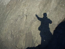
Stumped and Reflective on the Dobson Trail

i really have no idea about the rest of that day – i have few fotos, and no cache logs to help me remember – i know that i walked and walked and walked – a couple of likely campsites where i might have rested were already occupied

and i thought id find a decent campsite – i was ready to settle for anything that looked least ways comfy – at one point on a stretch of pavement i thought id call jamie and ask him to pick me up but i had no idea where i was

so i just kept walking until well after dark

i have no idea where it was – but it was late – going on an hour after sunset – when i settled into a small clearing – i made my bed under a big oak tree only about five feet off the trail – i slept fitfully until 11 or so – i was having such a time sleeping that i packed up and started walking – id figured id walk til i was tired and then rest again

P9030147

I came over that bridge in the dark with no idea how rickety it was. I camped just this side of the bridge before the last push homeward.

once i started walking i immediately regretted it – i was so tired – but i was determined to find a suitable campsite – much of the way i was walking in swamp again – or thick brush – id just have to keep looking

in germany more than a year later, i can still remember much of that night march, by times under the bright glare of the moon, by other times picking my way carefully through the dark woods by light of headlamp

i saw a thousand moose that night, a zillion bears and yet i just kept walking – i knew that if i just kept putting one foot in front of the other i would slowly and surely make it to moncton – i knew that every step i took there that night was one less step id have to take the next day

finally close to three in the morning i crawled across a loose log bridge, rolled out my sack in the middle of a brush pile and slept like a log myself til 7 – i was real surprised when i woke up to see just how decrepit the bridge was i had come across in the dark

two and a half hours walking on sore feet later and i was at the end of the trail – my team was there waiting with a hot tims – oh frabjous day – we found and signed the log of the cache at the very end of the trail

9.30 am
only one today. i never picked up any reception but then i didnt really try.
too wiped.
found this one using the clue only.
120th in two full days and one morning-before-breakfast on the trail
id like to come back and finish these up…

T4TC
“D

I was quite dead but none of the blisters on my feet were serious – a hot shower, lots of coffee and a lumberjack’s breakfast and i was okay.

Theres another 70 caches on the dawson trail (i hope i dont hurt anyones feeling when i say thats the only reason id ever think of going back there) … and lots more caches on neighbouring and intersecting trails… I hope i get the chance in the next couple years to spend another couple days of pure misery out there… Ill still have yet to break Woody’s 83 cache record… I think too, if i get in the right shape, that a hundred caches on foot in a day is possible too.

*And then of course there is always the ultimate, the holy grail of power cachers: the ET Highway, more than 1000 caches along the side of 158km of highway in the Nevada Desert… anyone game?

More fotos from the Dobson 120 on flickr

Tuesday, October 19, 2010

The Extraterrestrial Highway - Nevada route 375: 158km of Nevada desert, more than 1,000 geocaches

More than 1,000 geocaches are hid along Nevada's State Route 375 (The Extraterrestrial Highway) - one every 300m - all on the north side of the highway so if you drive er south to north youll never have to cross the road.... a great place to set a PR...

and what a place! the highway passes though nothing but desert, crosses a couple mountains of 1700m and most interestingly, it runs along the edge of Area 51...

I first heard about this place when i was gathering info to write about the little powercaching i have done - i thought it was a big deal that i found 71 caches in a day - but then i found Elin Carlson's blog about her run down the ET highway -  she found 90 in an hour and 355 before her car broke down...

i got the link to the first cache on the trail from her blog: ET 001 . one of the loggers there claims to have found 1021 caches in a 12-hour period. Thats nuts! Thats a cache every 45 seconds ??!! If you slowed down to only one a minute, then it would take 16 hours.

Anyhoo, Im adding it to the list... they say everyone should see Vegas at least once...

Saturday, October 16, 2010

the downward two-step: an English teacher's tips for getting through the subway like a superhero

Im taking the stairs two at a time these days - going down.

Ive always taken them two at a time going up but now im trying the much trickier downward two-step.

It all started a couple weeks ago walking from the bus to the subway - thats what i do for a living - im a business english teacher so i run from office to office - my job is essentially to be on time five or six times a day - once i get to each appointment, i chat a bit in english and then rush off to the next one.

i use all the tricks for travelling efficiently - i get on the subway last, so i can take the spot by the door and get off first, i choose my subway car based on which will be closer to the exit at my stop - im tall, so i can take the stairs two at a time going up... and now going down too

cause one day this kid with a skateboard had got my spot by the door on the bus, so i had to pass him heading for the stairs - i pass everyone anyway cause im fast and have a long stride - and you have to pass people before the escalators - its such a bottle neck - so i walk between the big pillars at the station while everyone else walks around and i get to the stairs first

the downward one-step used to put me on a level playing field with shorter people. sometimes theyd catch me again. the downward one step hobbled me.

so anyway, i passed this kid and then i did the downward one-step like a madman, trying my best to stay ahead or maybe even squeeze out a couple extra strides on him - if i was fast enough

and then this kid just dropped down the steps - whoosh - he was gone - he was taking the steps two at a time - on the landing i reeled him in a bit but then he dropped away again and was gone

the downward two-step - so smoothly - while carrying a skateboard - i was shocked, awed, impressed and most importantly: inspired.

since then ive been taking them two at at time too - slowly - getting comfortable - its a great new way to work your whole leg and improve balance and timing - i find myself looking forward to the steps, smiling as i approach a downward run of stairs - its so fun

my goal right now is to get comfortable enough with the downward two-step that i dont even think about it - after that, im going to try the downward three-step - and after that: flying.

ill let you know...

Thursday, October 14, 2010

Rugged and Punishing (hiking and caching on the musquodoboit trails, reposted from april 2009)

Great hiking only 1/2 hr from Metro

April 28, 2009

Musquodoboit Trailways

Musquodoboit Landscape, April 27, 2009
More photos on Flickr

Yet another FANTASTICALLY GORGEOUS part of nova scotia. i spent the day yesterday (14 hrs) hiking around the musquodoboit trail system. it's a beaut. about as nice a set up as ive seen anywhere in north america or europe (the extent of my experience).

i was of course hunting down geocaches. the place is littered with them. but given how greedy i was for caches (was hoping to log 43), i decided i would have to run/walk the beast.

and a beast it is. the wilderness trails are actually not runnable, period. occasionally i could trot along for four or five steps and then it was back to clambering. these are the wildest, roughest, most rugged and punishing trails i have ever travelled.

dont get me wrong: compared to bushwhacking around here, the trails these guys have hacked into the granite here are like an expressway. but that aint saying much. it's a twisted bit of countryside out there.

as a backbone, the trails make use of a 14 km stretch of old railbed running along the east bank of the musquodoboit river. with its gravelled even surface, benches, picnic shelters, bike racks, outhouses, lake and river access, and stunning lookoff platforms, the "Rail Trail" is perfect for the whole family. Either for long summer Sunday afternoons, an evening stroll or bike ride, or a winter cross country ski excursion.

If you really want to get into it, if you really want to see just how wild and whacked out is the wilderness in Nova Scotia, then try one of the wilderness trails.

the topsoil is thin and the boulders big. the trail twists and turns around the bigger rocks but just goes straight over most of them. or squeezes between them. or in one spot, the trail actually leads you right under the rocks.

Talus Cave

That yellow marker means "This way." The trails goes right through those rocks.
More photos on Flickr

Typical Trail

Yes this is a trail. The yellow marker proves it.
More photos on Flickr

Blocked

Whenever a tree falls, it seems the only open space for it to land is... the trail!.
More photos on Flickr

tree roots, fallen branches and in many spots, whole trees lie across the path. it's very easy, if you are not paying close attention to "lose" the trail, to find yourself standing on a mossy boulder surrounded by deadfall, with no idea how you got there or if you'll ever make it home again.

the trail designer must really love a path that goes up and down. often. steeply. and with no compassion. you will sweat. and curse. and maybe even cry.

for all that, the views are worth it. there are many well-placed look offs with views over the musquodboit river and the many lakes, out to harbour and the ocean.

there is a romantic, if somewhat tortured, beauty to the landscape here. white granite litters hillsides and ridges, trees line up in twisted formation along gulleys, and lakes fill the depressions, in the valleys and between hilltops, whereever you look, islands and boulders pepper the still, dark, tannin-heavy waters.

the real beauty of this place lies in the rock (at least for me, im a capricorn after all): sheer cliff faces, boulders and slabs of rock as large as houses erupt from bushy swamps and stands of gnarly spruce and pine. lichen and moss sprout and bloom like carpets on these, the only real flat surfaces of the nova scotia woodland.

there are maps and trail descriptions and lots more great info on the website of the Musquodoboit Trailways Association.

For the record, it took me 14 hours to cover 30kms and find 42 caches. I was totally humbled by the terrain. I can't wait to come back and take my time, take some photos, and take it all in.

dont underestimate this place. give yourself lots of time, take it real slow and be prepared. theres lots to talk about under being prepared:

1. you want to be in reasonably good shape. for the climbs (lots of them) and descents and for the constantly lifting your foot over a root, or climbing down off of rocks.

2. you'll want to bring lots of water. the water out here is not safe to drink and you're going to need lots. dont forget food to fuel you around this workout posing as a walking trail.

3. topo maps are usually available online, at the trail heads or at the trail interpretative centres in musquodoboit harbour. very helpful. compass and or GPS (and the knowledge to use them) essential.

4. plan on sturdy footwear, pants or gators, and warm clothes just in case.

5. bring a camera baby, or an easel and canvas. it is gorgeous.

P4270015 P4270051 P4270038 P4270081 P4270093

10 Tips for the PowerCacher (reposted from April 20, 2009)

[This was written before my biggest day of power caching - on Sept.1, 2009 I found 71 caches while hiking the Dawson Trail in NB. Im currently writing something about that experience, and I came across this old piece while gathering info and thought id just repost it here so i have an archived copy on posterous.]

April 20, 2009

Even before I finished writing this shite, I regretted it. Used to happen to me quite often when writing for the paper. This whole article is boring, unfunny, self-important and not that helpful really. Certainly not inspiring. Which is my feeling about powercaching in general. And worse, while Id still feel the pull of big numbers, I find the whole process of finding that many boring caches quite disheartening. Ive set myself the goal of reaching 1,000 finds this year, but now I have no idea why. More about this is in a post soon.

Geocaching isn't about the numbers, people will say. And I mostly agree. But still there is something very addictive about the searching. As soon as you find one, you want to find another and another and it can be really hard to stop...

At first people are thrilled to find one or two. The next time they go out, they might be ecstatic to find four or five. And so it goes. Then you find a few PnGs (park and grabs), and the wheels in your head start turning. Finally you discover pocket queries (A database search at geocaching.com that lets you load the coordinates for 500 caches into your GPS with the click of a button). Next thing you are wondering just how many you can manage in a day...

I did a big car-based caching tour last week. There is a whole series along the backroads of East Hants called the OHBOY series: Old Highways and Backroads Of Yesteryear.

I was taking my son home from Dalhousie anyway and so we decided to make a day of it. My son drove and I hopped in and out of the car, jumped over ditches, splashed into swamps, scrambled over clear cuts and juanfalls, whacked through the roadside brush, peered under bridges, all the while searching for little camo'ed pieces of tupperware. And signed my name 40 times.

Here are the top ten lessons from my first 40-cache day:

10.) Car-based turbo caching might not be as relaxing as a walk in the park. If you are going for big numbers and want to maximize your use of available time, you will not be taking much time to smell the roses. Make sure the whole team agrees on the goals and the effort that will be necessary to attain those goals. Many roadside caches are boring and monotonous. Racking up big numbers in this manner is not for everyone.

9.) Plan the route to include coffee shops but also bring ample supplies of water, snacks and caffeine. Your route plan might well break down and good nutrition is important to maintaining concentration and energy levels over a long day in the outdoors.

8a.) Prepare a list of caches you intend to find. Pour over the maps the night before and write your list in the order that makes sense to go after them. Include driving directions in between the cache listings, if the driving is less than straight forward. The list is also a big help when it comes to keeping track of your finds and any notes about the caches (like maintenance issues or trades).

8b.) The list should include, at a minimum, the cache name, difficulty and terrain ratings, and the clue if you are a clue reader. (If you are going for big numbers, then you probably want to read the clues.)

7.) Provide each member of your team with a list so that the record keeping duties can be split. Eg, your driver can check off the find and write in the time as soon as he sees you have found the cache.

6.) More than one GPS is a big help even with only one searcher. In our case, my son would have been able to set the GPS for the next cache while I was searching. With several searchers, they could continually be leap-frogging caches. And in the case of tricky hides with poor reception, the more receivers the better...

5.) Keep your pen super accessible. If things go well, you'll be signing your name often and frequently. For example keep the writing stick on a lanyard around your neck or in a pocket protector. My approach: sliding the pen into my watch strap. Works wonderfully.

4.) Drive as close to the cache as possible and then dash for it. Don't however waste time backing up short distances, turning around or parking on the wrong side of the road. The driver should watch the searcher(s) to make sure the car is well-placed when they return. So if the cacher ends up way behind or in front of the car, the driver should adjust accordingly. The car should always be positioned so that it can drive forward once the cachers return.

3.) Your feet are going to get wet eventually. So don't waste time trying to keep them dry. Wear comfortable athletic supportive shoes with as much waterproofing as possible - shoes you wont mind walking in ditches and swamps with.

2.) Take breaks. Either build in beautiful or interesting caches (like an Earthcache at a bat cave) with the intention of taking it slow and enjoying yourselves, or plan eating/ resting breaks. Maintaining concentration will be challenging over a long hectic day. Clear minds are especially important considering that you will be jumping in and out of a vehicle on the side of roads and highways. Stay sharp. Plus it would be nice if you were able to remember at least one of the caches you visit.

1.) Turbo caching will never be as fun or rewarding as the caches that lead you to a beautiful spot you never knew existed, or a multi that challenges you physically and mentally, or as caches that you have to work away at, puzzling, climbing or otherwise striving. Quantity will never trump quality. It is fun, sure, to see how many you can get, but it will never be as fun as the really good caches.

I have no idea what the single day cache logging record is... I know a group of four who logged 83 in a day. I have seen forum posts where people are claiming 240, 260, 270 finds in a day... ridiculous... it would have to get boring - with the only interest residing in the numbers...

For me caching is about so much more... in an upcoming post...

P4180031 B&T's First Find P1220023 P1180128 PA280077

Tuesday, October 12, 2010

The toughest damn paddleboat cache ever

a story of the nerdy and childish extremes of geocaching

[SPOILER WARNING! DO NOT READ THIS BLOG IF YOU HAVE NOT YET FOUND STRANGE MATRIX in DUISBURGER WALD ]

On our way to first paddlecache

On our way to the toughest damn paddleboat cache ever

On Sunday, working with a couple kids, I logged my first paddleboat cache. Strangely this was a big deal for me.

I have been “geocaching” now for almost three years, yet there is always something new and interesting to keep me hooked.

We are talking about a high-tech game of hide and seek. Players hide small containers, post the GPS coordinates online and then others go looking. In every cache there’s a logbook which you sign to prove you found the cache. Today there are a more than a million caches hidden around the world. They are everywhere.

I have logged caches by kayaking to islands off the Atlantic coast of Nova Scotia, by hiking two days into the hills of Cape Breton, climbing mountains in Switzerland, crawling under the Autobahn in Germany, grabbing a magnetic micro-cache under the nose of a bomb squad in Washington D.C. the day before Obama was inaugerated.

I have swum across rivers, crawled along the ledges and narrow paths through the grapevines of the Mosel, ridden horses 2km out to sea on the mud flats of the North Sea, and last weekend we used a canoe to pickup caches in the middle of a lake.

Yet this paddleboat cache, with the boys, was one of the toughest and most rewarding Ive ever done. And quite nerdy to boot.

my geocache finds in saarn

Last winter this map was all smiley faces except for Strange Matrix but there's a whole batch of new caches there now.

In the end on Sunday it looked like child’s play, a little trip round a duckpond in an old beat up paddleboat enjoying the sunshine and fall colours. But I had actually been looking for this cache, Strange Matrix, since March, back when the ponds like this one were only just starting to melt.

This whole story started because we were moving, and before we moved from Saarn, I wanted to find all the caches around the spot where we were living.

On the geocaching.com website, you can see all the caches around you on a version of googlemaps. Normal traditional caches show up on the map as little green boxes. Those are simple caches. You go to the given coordinates and look for the cache.

I had cleaned up all of those around our house for a few kilometres. Once you have found a cache and logged it online, the boxes turn into smiley faces on the map.

There are also bigger gold boxes. Those represent “multi-caches”; caches where you have to find clues at several stations before finally finding the cache container. Germans love multis; it’s the big difference between North American caching and German caching.

The maps here are covered with gold boxes, at home the boxes are all green. I had also invested a fair bit of time and effort turning all the gold boxes round our house into smileys.

But… there were still two blue question marks on the map. Those are puzzle caches: caches which involve some kind of puzzle or riddle or mystery. Puzzle caches can be tricky because their location on the map often has nothing to do with their actual location.

I had slowly been solving these riddles (it was winter and it was nice to sit inside and dream of going out) and there was just on left – StrangeMatrix. The cache description was incredibly sparse; just this image:

Strange Matrix. Can you see Jesus?

And just these words:

The cache location is surrounded by old barbed wire. However, there are at least two points without.

Plus a clue:

Inside a hollow stem.

I tried staring at the image and letting my focus blur. For an hour maybe. At one point I thought I saw Jesus, but he couldnt help.

So I studied the logs of the people who had found the cache. Lots had found it in the summer and then no one for a while.

Until suddenly in January one group went and then others followed. All of them suggesting that the “weather” was finally right for getting to the cache. We’d had a chilling cold snap in January… a couple mentioned “wet feet” and it occured to me the cache must be in the middle of a pond or lake.

In Canada I had found a bunch of normally very difficult lake caches, just by waiting for January and walking across the ice to them.

Since I wasnt getting anywhere by staring at the image, and since I knew the woods round the area pretty well, I decided to try what I call brute force to solve the cache: just going out and looking.

Now, as I said, a puzzle cache’s posted coordinates usually have nothing to do with where the cache is actually hidden – but often the coordinates are in the neighbourhood – so I figured I would just look for any ponds, surrounded by barbed wire with little islands in the middle – how hard could that be?

Turns out there were way more ponds in the area than I was aware of. Lasti, our Golden Retriever, and I spent the whole morning March 7, 2010 tromping round the woods, sneaking under fences and coming up empty.

P3070009

Lasti the Golden Retriever and I searched every pond in the neighbourhood incuding the island in the middle of this one.

Here’s an extract from my diary from that day:

we followed every stream and ditch until we found this pond – with an island in the middle – and a log bridge leading out.

i dont know what little devil drove me to climb out there but next thing i know, im jumping off the thin end of the stump. and as im jumping, im realizing the

Saturday, October 09, 2010

Jony swimming a short tunnel in the powerhouse (a local swimming hole in nova scotia) August 2009

Download now or watch on posterous
P8200031.AVI (7040 KB)
August 2009

Prospective Paddle Caching (Aug. 2009) with Simon & Co

People here have no idea. If I showed them this first foto and told them this is what i miss most about canada, theyd say we dress funny. they would totally miss the keiths in simons hand. jesus when is the last time i had a skunky ol keiths? man oh man

anyway we squeezed in a damn fine weekend last year. id been guiding a bus load of tourists all week til like 8pm that night, then to dartmouth, pack, down to lower prospect and heaven was waiting for me: beer boats and a BBQ - i of coure had no idea, that night i would compose that moumental little chestnut: "Little Gnome, Little Gnome"... you had to be there. More fotos (33) on flickr.

The way home

P8160544

P8160431

P8160414

P8160397

Gnome Urlaub [Holiday]

As you can see there are more caches out there to find, and more islands needing a cache...

Thursday, October 07, 2010

Paddling in Germany (hint: involves beers and sausage)

PA030173

Hunting for geocaches in the middle of the Baldeneysee

I just about drowned in the flood of familiar sensations.

It was so awesome to get in a boat this weekend, to feel the waves under the keel and the wind on my face; to hold a paddle in my hand, pull the blade through the water and feel the boat accelerate, to twist the blade and feel the boat pivot – it felt like a hundred years ago, like Canada.

We live just above the river Ruhr here in Germany and all summer we talked about joining a canoe club or renting a boat but somehow we never managed it. Finally, this weekend, the first in October, we decided it was now or never.

I worked Saturday, and then, despite a promising forecast, Sunday dawned a little too uncertainly. The man at the kayak shop too did his best to talk us out of going – too windy, the water is 14 degrees, wah wah wah…

We listened, we went anyway and it was awesome. The sun came out full and forceful, the wind died away to nothing but most importantly: we were on the water.

We rented the boats in Kupferdreh, at the east end of the Baldeney Lake, a dammed up section of the Ruhr south of Essen. The lake is s-shaped, 500m across at the widest point and if straightened out, approxiamately 7km long.

PA030171

In the quiet canal discussing the wisdom of entering the Darkness

It was Sunday afternoon and the lake was chock-a-block with sailboats and kayakers, paddleboats and every 15 minutes the big white river ferry came through. We hurried down the shore past the ferry dock and ducked into a little canal away from the crowds – a quiet sheltered corner – a great place for a cache

Sure enough, tucked away in a little recess was a piece of plastic tupperware – we swung the canoe in sidelong and reached through a curtain of thorns to log our first canoe cache. I have found caches by kayaking to islands, by wading and swimming across rivers, and even by walking across frozen lakes, but never a drive-in canoe cache before. In one day, my first European canoe trip and my first canoe cache. Oh frabjous day!

At the far end of the small canal was a large tunnel – 10m wide, 4m high and disappearing into the darkeness – pitch dark – we drifted in maybe 40m – but as the light dimmed and dimmed and there was no light at all coming from the other end of the tunnel, the others lost their nerve and mutineed.

We turned around but agreed, that someday, with headlamps and flashlights, we’d go all the way through – the stream is the Deilbach, it’s springs up about 20km away in Wuppertal – the tunnel itself is about 500m long, passing under the autobahn A44. (Why is it everytime I reach one goal, I end up setting more?)

PA030172

Heike displaying great balance as she reaches for a cache

From here we headed out onto the open lake. Following the GPS we crossed to the north side and paddled by a line of yellow posts with some kind of warning sign ontop – the words were bleached out and we couldnt read them – so we paddled on.

We maybe should have put two and two together when the big flocks of cormorants and blue herons flew up from their roosts in the trees along the shore. A beautiful sight but it made me a little uneasy to disturb them. The GPS led us farther out into the lake to one of the yellow posts. This one we could read:

Bird Sanctuary Area. Do Not Enter.

The cache we were headed for is actually called “Bordering on Illegal” – but I didnt understand why til it was too late. Heike stood up in the boat to reach a little vial-like cache container hidden in the yellow post – and suddenly it seemed like every kayaker on the lake came over to see what we were doing and to tell us to stay out of the bird sanctuary.

Thankfully they were so busy giving us instructions they didnt notice when Heike passed me the cache or what she was doing when she put it back.

PA030168

My hearty crew mutineed at this point and would go no deeper into the darkness. Next time!

These first two caches contained the coordinates for a third which we quickly went after. The GPS led us to a pumphouse on the shore of the lake. The cache description had advised bringing a mirror along.

We groped and felt around under the floor but couldnt find the thing. Finally after the other two had gotten out to look from land, i tipped the boat over practically level to the water and grabbed our final cache of the day.

Having accomplished our goals for the outing, we headed back to kupferdreh and pulled up on the shore near a little biergarten – this is canoeing german-style – with beers, bratwurst and fries at a table in the sun.

The biergarten was full of cyclists and walkers – we were the only ones in PFDs – and from our table we could watch a steady stream of bikers, walkers and inline skaters making the 14km trip round the lake. too many people on land so we headed back onto the water.

the river was full too – of paddlers and motorboats – we headed up stream as far as an ancient mill – now the site of another biergarten – time for another break – and so was established the pattern for the rest of the afternoon – paddling in Germany is not exactly like paddling in Canada – but i could get used to it

[not only are we planning to go through the tunnel, we're also planning a longer run down the ruhr - from horst to kupferdreh is 10k, from hattingen its 20k - of course id love to do the whole 200km run from winterberg to duisburg but i dont know who would come with... ... any takers?]